2.7 Distinctive Australian biomes
Rainforests
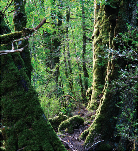
Rainforests are tourist magnets. It is interesting to look at maps of Australia and see where there are areas of rainforest. Source 2.21 makes it look as if the ‘tropical’ biome extends right down the east coast of Australia to Tasmania and across to Western Australia, but this is not the case.
The issue is complex. How do you define ‘rainforest’? Is it simply an area that is wet and has a forest cover? Or is it more than that?
There is clearly a problem with the definition of ‘rainforest’. Is the term being used to describe any type of forest found in a wet area? Is it the amount of rainfall or the characteristics of the vegetation that defines the biome? A ‘rainforest’, according to climate definitions, has to have an annual rainfall of more than 4000 millimetres.
Many vegetation geographers or biogeographers prefer the term ‘vine forest’ for the forests of north Queensland, as it is an indicator of the type of vegetation. However, the term ‘rainforest’ is very well known and will probably remain. It is worth knowing that there are different ideas about rainforests around the world.
Mangrove forests
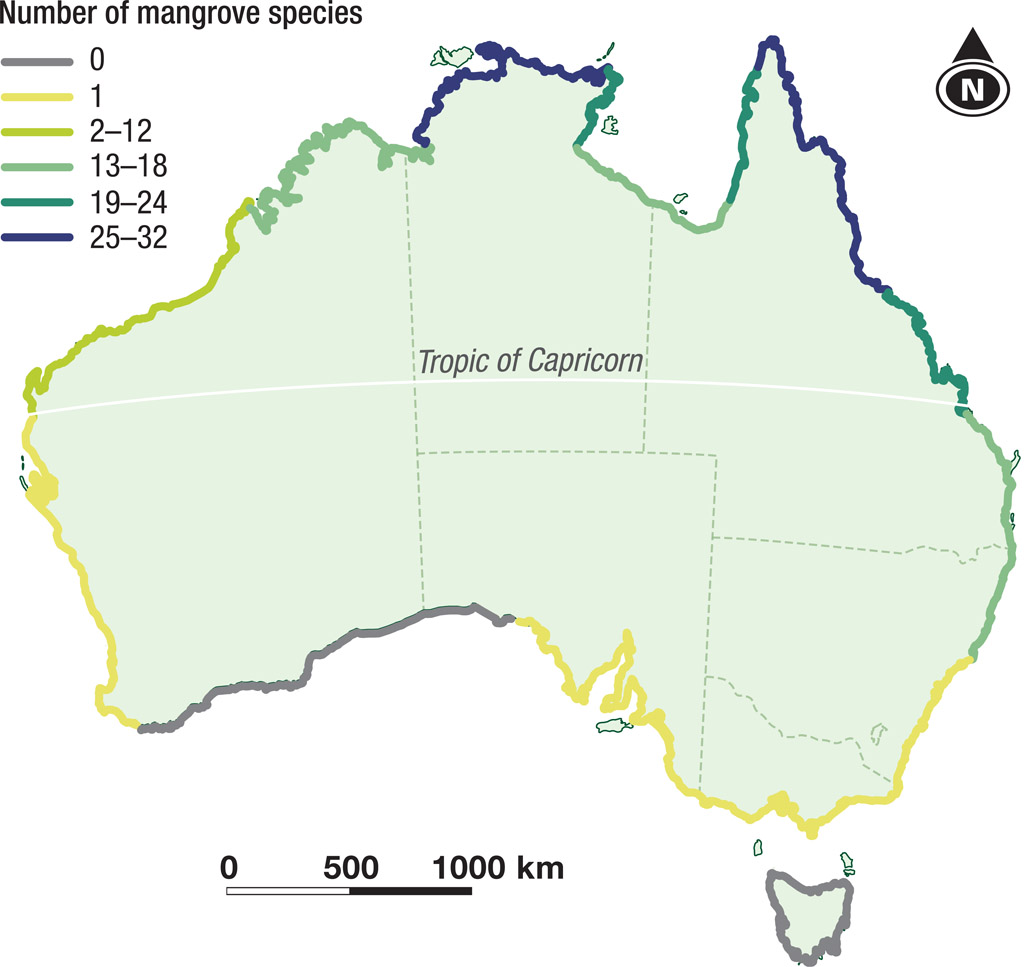
Mangrove communities are a very distinctive biome worldwide, but they don’t make it onto the small-scale maps because the communities are found on narrow stretches of coastline. Source 2.25 shows the distribution of mangroves around the Australian coastline. It provides a few ideas on what factors affect the distribution of mangroves.
DEVELOPING YOUR UNDERSTANDING 2.6
Examine Source 2.25 and identify the following statements as either TRUE or FALSE.
- Mangroves are found right around the coast of Australia.
- Only one species of mangrove is found south of the Tropic of Capricorn.
- Queensland has more mangrove species than New South Wales.
- There are no mangrove species in Tasmania.
- Mangroves are a tropical plant.
-
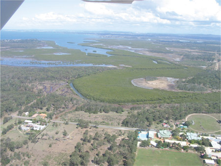
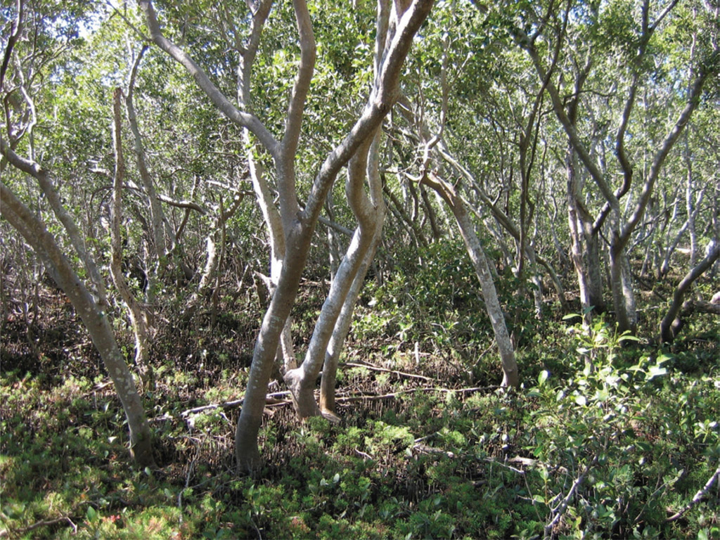
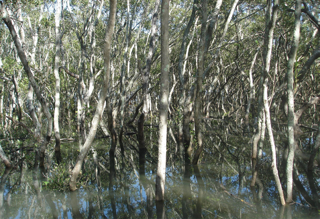
Source 2.26 Mangrove community at Hays Inlet, off Moreton Bay, Queensland -
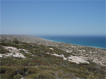
Source 2.27 The Great Australian Bight, where sand dunes and limestone cliffs face the relentless swells of the Southern Ocean and no mangroves are found
Source 2.26 shows part of the mangrove community found around the shores of Moreton Bay. If you holiday at Surfers Paradise, you will not see mangroves growing on the beaches there. The coastline is too active for mangroves to grow, as it is open to strong wind and wave action. Mangrove communities grow in quite calm, salty waters. They are very similar to rainforests.
There are no mangroves in Tasmania because the temperatures are too low even for Avicennia marina, the one species of mangrove which can tolerate cooler waters.
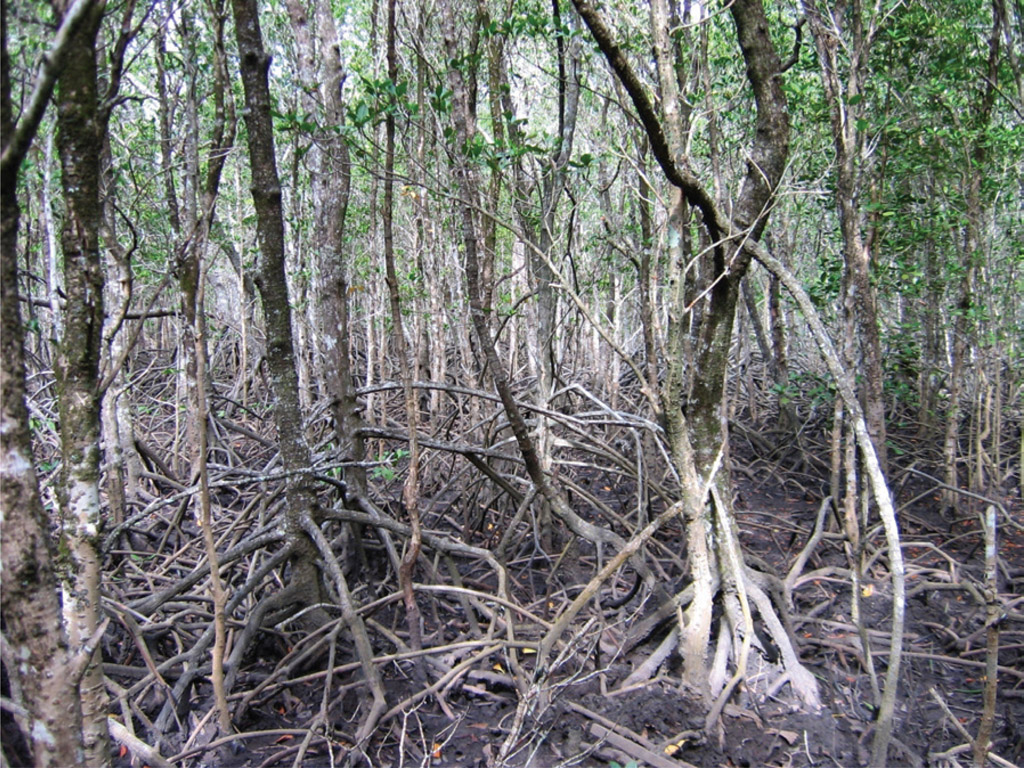
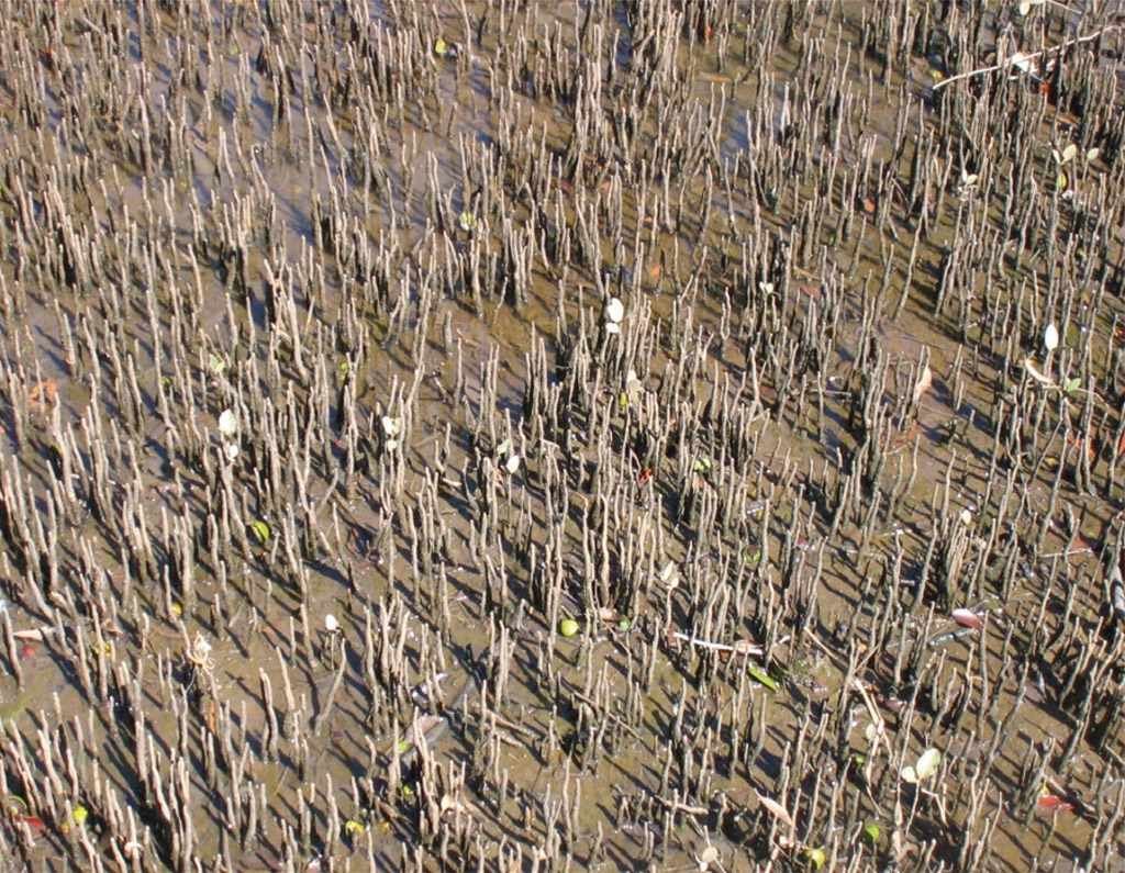
Mangrove communities are very dense, and many have a closed canopy. This cuts out light to the lower layers so that there is no competition from various other species. The mangrove communities drop a lot of litter – leaves and branches – and this decays and provides plant nutrients. The lower layer is usually made up of young seedlings waiting their turn to fill a gap in the canopy. Like the trees in a rainforest, mangrove plants have many adaptations which help them survive in their difficult environment: Source 2.29 shows the buttress roots of Queensland’s red mangrove, which helps support the plant in this muddy environment, and Source 2.30 shows the special root system that many mangrove plants have developed. These are breathing roots, which assist as the tide comes in and eventually covers the root system completely. These roots are known as pneumatophores.
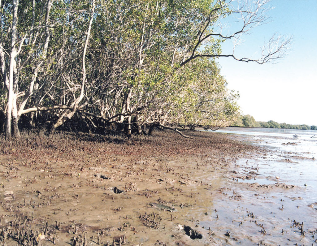
Source 2.30 also shows another important feature of the mangrove plant. The root system traps silt and mud and builds the land up. Source 2.31, taken in Deception Bay, Queensland, shows the mangrove root systems extending into the bay and building the land up.
As the land is built up, the environment changes. The land is less likely to be inundated by salt water, so other plant species are able to colonise the area. This results in a transition from one biome to another. In this case the transition is to salt marsh plants, which have their own ways of combating salt, then to casuarina forest, and then to the climax vegetation, eucalypt forest. These changes can occur in the space of a couple of hundred metres, which means they do not show on the small-scale maps of world biomes.
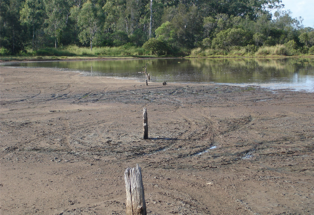
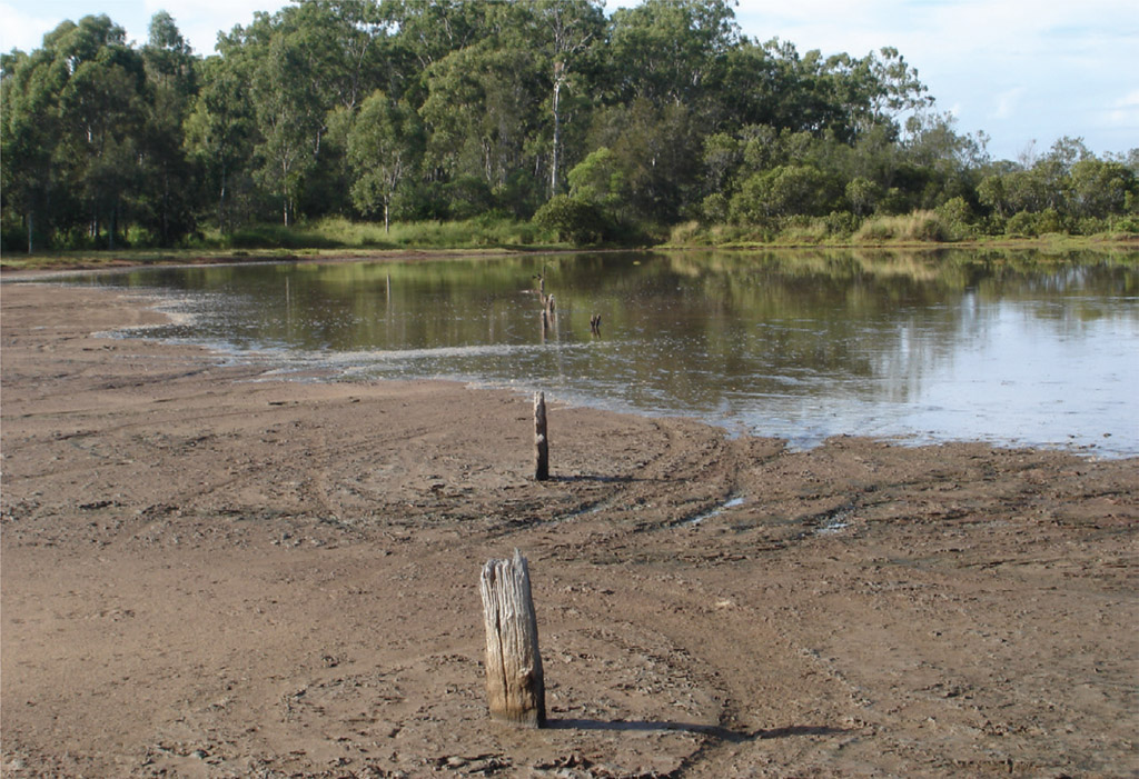
An interesting factor to add here is the impact of rising sea levels. Examine Sources 2.32 and 2.33. The king tides only reach this area on a few days of the year. In Redcliffe (Queensland) these tides occur in January and February. Plants growing in this area, including the mangroves, have to adapt to this inundation. Source 2.34 shows the mangrove community at the maximum king tide level.
DEVELOPING YOUR UNDERSTANDING 2.7
Deserts
A desert is defined by having one of the following two climate features:
- 250 millimetres of annual rainfall (or less)
- vegetation covering less than 50% of the ground.
The following research activity will show you how Australia’s desert biomes have developed
Oceans make up 71% of the Earth’s surface. This means 29% of the Earth’s surface is land. Deserts make up 33% of the land’s surface area. In other words, deserts make up one-third of the land’s surface area.
DEVELOPING YOUR UNDERSTANDING 2.8
- Explain why the term ‘rainforest’ should be used more carefully.
- Analyse why people in places far from the tropics consider their forests ‘rainforests’.
- Describe how mangroves have adapted to growing in salty water.
- Compare the mangrove communities of South Australia and the mangrove communities of north Queensland.

